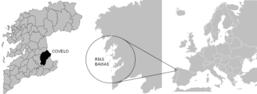
Covelo is a municipality located in the province of Pontevedra, in Southern Galicia, a region in the Northwest of the Iberian Peninsula. Covelo is mainly a rural area of stunning landscapes, deeply influenced by two natural elements: O Suido mountain range and the River Tea. Both elements have are responsible for the area’s characteristic orography.
- The mountains of O SuĂdo are visible from nearly every distance within the municipality. Wandering cattle, villages and other man-made constructions peacefully co-exist in these mountains, except for the uncomfortable presence of wolves. All these elements provide the area with great value.
- These lands hide the River Tea’s source. The Tea is one of the better preserved rivers in Southern Galicia and presents interesting and rich habitats. Several fish species such as eels, trouts or salmons populate this river. Other animals such as beavers live here. Very often, the vegetation in both river banks meets over the river to form a canopy, giving the landscape a bucolic and beautiful aspect.
The local neighbours have lived on this land’s natural resources for centuries. This relationship between man and nature gave rise to a rural landscape modelled by the influence of traditional agriculture. Every corner in this municipality hides privileged places and landscapes, inviting the visitor to find out more at every step. The Town Council authorities launched new technologies in order to make the visitors’ experiences even more enjoyable. All you need to feel, visit and listen to Covelo’s wonders is an mp3 player, mobile telephone or GPS with audio reproduction. Why don’t you give it a try?
The River Xabriña deeply outlines the aspect of this route’s landscapes. The river runs accross high natural value ecosystems,where you can also find samples of a rich traditioanal architecture mainly connected to the exploitation of water. You will have the opportunity to visit watermills, traditional irrigation ditches, and eroded paved little bridges, among other constructions.
There are also interesting traces of a past important wax making activity in the villages of Paraños and A Lamosa.
- Route’s name: River Xabriña route. PR-G 119
- Type of route: cyclical, with alternative road divertions in order to make a shorter walk. It is recommended to walk this route counterclockwise
- Departure point: Village of Paraños
- Arrival point: Village of Paraños
- Alternative divertions: A Lamosa, CorzĂłs, Prado da Canda
- Difficulty: medium
- Length: 17 kilometres
- Estimated time: 6 hours
- Medium: 1
- Itinerary: 2
- Distance: 3
- Effort level: 3
The AQA route runs through a natural area influenced by the constant presence of water. Water gave rise to this landscape of valleys and depressions. The route will carry you through several heritage elements related to the exploitation of water, such as irrigation ditches, fountains and watermills.Some of the most interesting sites along the route are the river beach of Maceira and the church of Barcia de Mera.
- Route’s name: AQA route
- Type of route: lineal, with three clearly marked main stretches and a divertion. This route shows different departure points
- Departure point: Covelo
- Arrival point: Barcia de Mera
- Alternative divertions: Lourido, River beach of Maceira, Redondo, Barcia de Mera
- Divertion: Lourido - Redondo
- Difficulty: low
- Length: 15,6 kilometres
- Estimated time: 6 hours
The path runs parallel to the River Tea most of the time. Together with the river, the old water-powered sawmill of Os Carranos is one of the most outstanding sites in the area. The route is named after this sawmill. While walking this route, you will have the opportunity to visit the river beach of Maceira and the priest house of Fofe. This priest house is both the departure and arrival point.
- Route’s name: Os Carranos route. PR-G 95
- Type of route: cyclical
- Departure point: Priest house of Fofe
- Arrival point: Priest house of Fofe
- Divertions: Porta Liñares – River beach of Maceira
- Difficulty: low
- Length: 8 kilometres
- Estimated time: 3 hours
- Medium: 2
- Itinerary: 2
- Distance: 3
- Effort level: 2
The route of Poza Piñeiro runs across the O SuĂdo range of mountains, defined by its rough geography and nature. Both, these mountains and the river Tea, give high natural value to the area. One of the few remaining wolf communities in Galicia survives here. The pond, also called A Poza de Piñeiro, is an important element of the landscape. This man-made dam was originally built in order to store the water for the irrigation of the surrounding farm lands. Nowadays it is considered a site of natural importance. The route offers stunning views over the valley carved by the river Tea.
- Route’s name: Poza Piñeiro route
- Type of route: lineal
- Departure point: Village of Piñeiro
- Arrival point: Poza de Piñeiro
- Difficulty: medium - high
- Length: 7 kilometres
- Estimated time: 2 and a half hours